2 June 2023 by Paul Collins
Remote Sensing is the process of detecting and monitoring the physical characteristics of an area by measuring its reflected and emitted radiation at a distance. Well, that’s the scientific definition!! What it means for the project development team at rePLANET is leveraging the latest scientific research, technology and hardware to answer nature based questions around the degradation of forest and mangrove areas, worldwide, with a view to restoring them and generating all the positive climate and nature benefits that are inherent to restoration.
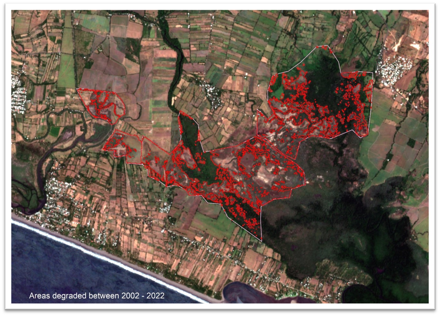
We work closely with local partners in many different countries around the world to identify areas that have been subject to degradation over the past 20 to 30 years. Using their local knowledge, we then acquire the latest high resolution multispectral satellite imagery to confirm the degradation, and historic multispectral satellite imagery, going back up to 30 years ago, to confirm when this degradation took place. From these images we can quantify, approximately, the area of degradation in terms of hectarage.
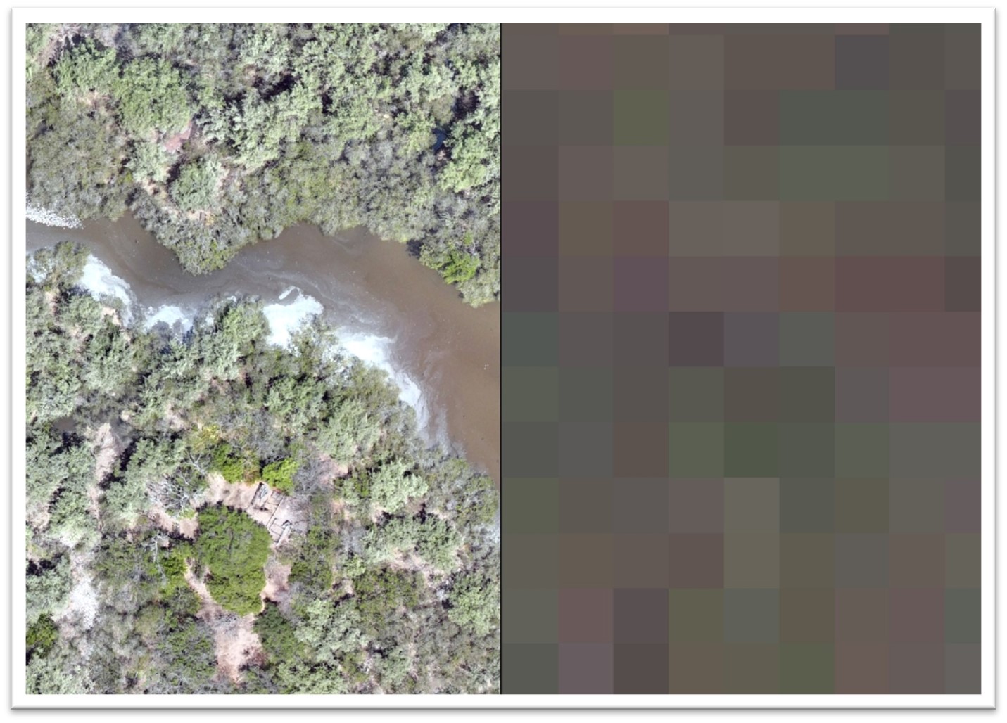
Whilst multispectral satellite imagery is an extremely powerful research tool, and one that we leverage almost daily, it can often contain significant cloud cover, especially in tropical areas, and can be limited in its ability to detect small changes due to the resolution i.e. the pixel size relative to features on the ground. To overcome this rePLANET deploys teams to the field using the latest multispectral drones which can capture significantly higher resolution data, sometimes giving us pixels that represents 1 centimetre on the ground. This allows us to not only identify the small changes we might miss in the multispectral satellite imagery, which is often 10 – 30 metre pixels, but to establish a highly accurate baseline for when we take the project forward to restoration as we are able to identify new saplings and even monitor and quantify their growth over time. In addition to the resolution, multispectral drones can capture data from different wavelengths of the electromagnetic spectrum which allows us to create many different data sets for further analysis such as NDVI (Normalised Difference Vegetation Index). These indices allow us to differentiate between cleared areas and vegetation and also assess the health of the plants within the data set.
NDVI image on the left and corresponding RGB image on the right. 11CM pixels/resolution.
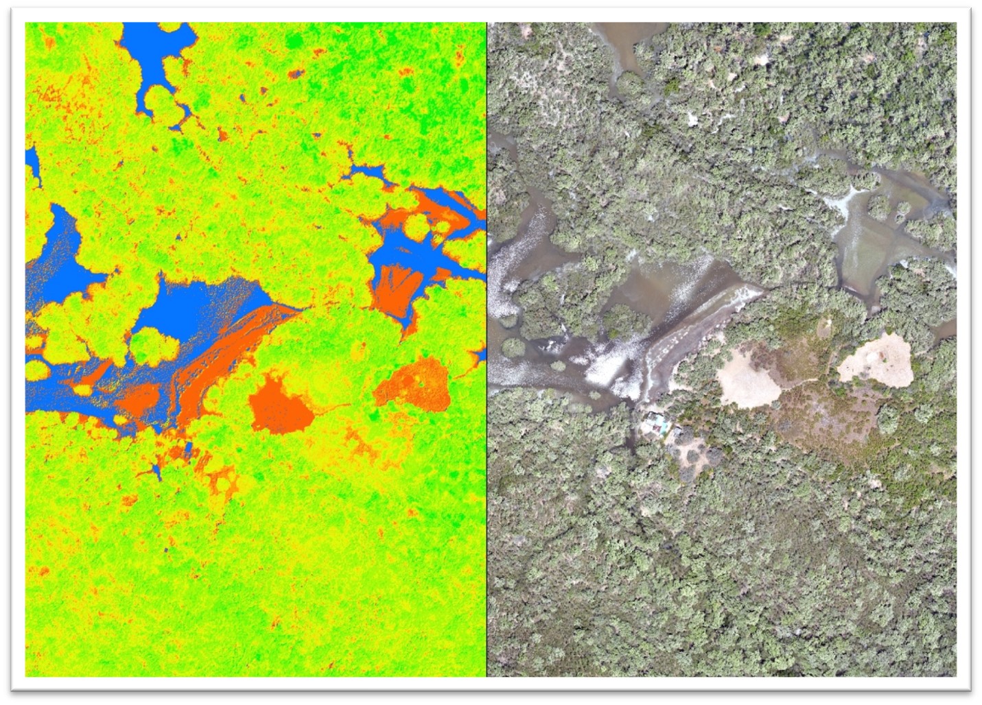
Drone imagery on the left, satellite imagery on the right of the same area – 11CM drone pixels, 10M satellite pixels.
The latest drones not only provide us with high resolution multispectral imagery, they are able to capture Digital Elevation data. Digital Elevation Models are a representation of the bare ground (bare earth) topographic surface excluding trees, buildings, and any other surface objects. These models can be fundamental to designing restoration projects where regeneration of the hydrology is critical to the success of the restoration work. They can also be extremely useful in other planning requirements. Whilst designing a surveying strategy for a project in Transylvania one of the requirements was to identify land parcels with a slope angle of less than 13 degrees within high value grassland. After flying the drone, we were able to create an NDVI (Normalised Difference Vegetation Index) image to distinguish grasslands from forest and arable land and then subset this by slope angle to ensure we only surveyed the applicable areas.
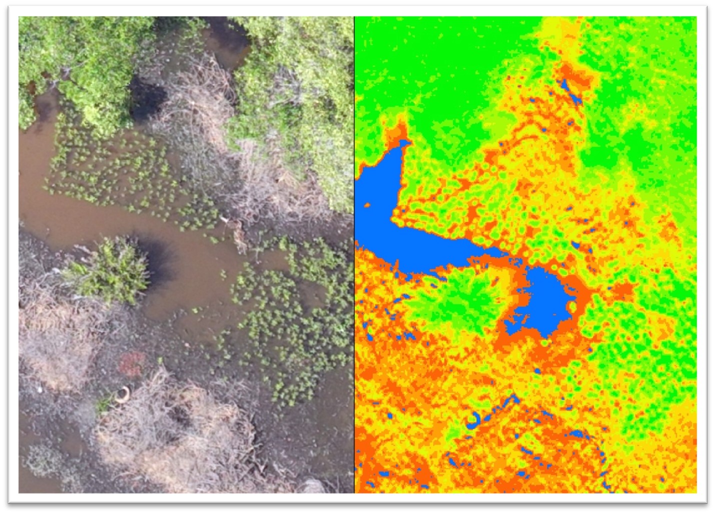
Drone image on the left showing small new saplings and the corresponding NDVI image showing the new saplings.
Remote Sensing technologies are constantly evolving and going forward we will be deploying Radar and Lidar data solutions to leverage the benefits these technologies afford such as the ability to penetrate through extensive cloud cover and to allows us to calculate carbon sequestration rates for forest and mangrove stands. Ultimately all these technologies are employed in the pursuit of nature based remediation and enhancement of the natural areas within which we work, for the benefit of the local communities that rely on the services nature supplies them, and the rest of the world.